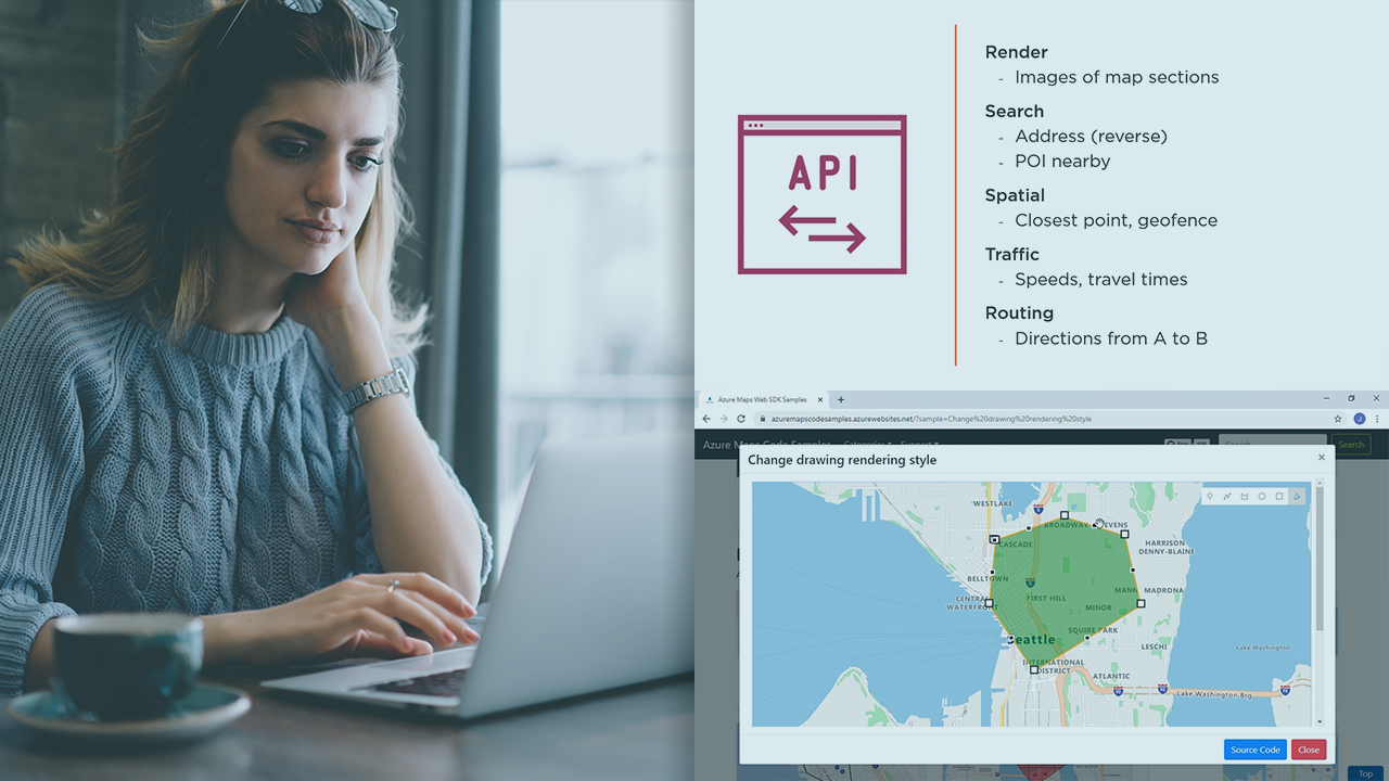
We live in a world that is GPS-driven. Tracking objects is at the core of many new businesses. What if you have to develop an application that needs to show the location of persons or assets on a map? In this course, Getting Started with Azure Maps, you’ll learn to use powerful geospatial capabilities in the Azure cloud to drive your location-aware web applications.
First, you’ll explore the services that Azure Maps offers, to give you an idea of its potential. Next, you’ll discover how to employ the controls from the Web SDK to display objects and areas on an interactive map. Finally, you’ll learn how to use the Search REST API to look up address information.
When you’re finished with this course, you’ll have the skills and knowledge of Azure Maps needed to create map-oriented applications.
Find the course here.